
Tropical cyclones are powerful and destructive weather systems that form over warm tropical ocean basins. where sea surface temperatures are above 26.5 degree C. These storms are characterised by strong winds, heavy precipitation and storm surges and can cause significant damage to coastal communities and infrastructure.
Climatologically, tropical cyclones form mainly in the North Atlantic, East Pacific, West Pacific, South Pacific and the Indian Ocean. Out of 85 tropical storms that develop annually over the warm tropical oceans, more than half (45) of them intensify into tropical cyclones. The Western Pacific basin is the most active region for tropical cyclones and accounts for about a third of the world’s tropical cyclones. The North Indian basin accounts for only about 4% of the global total, although it is one of the most vulnerable regions in the world to the effects of such cyclones.
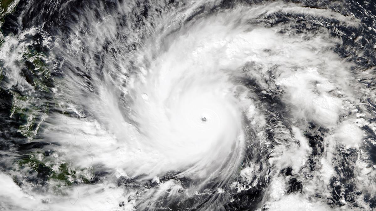
The Saffir-Simpson (SS) hurricane wind scale, introduced in the early 1970s, is the most widely used metric for warning the public about the dangers of tropical cyclones. The SS hurricane wind scales are categorised by the maximum sustained wind speed at a height of 10 metres. Although most tropical cyclone-related deaths are caused by storm surge and heavy rainfall, wind hazard remains an important metric for communicating risk to the public and a critical metric for measuring the impact of these cyclones. There are five categories on the SS hurricane wind scale — category 1 to category 5 — with category 5 wind speed exceeding 252 km/hour. The combined effects of wind, storm surge, and rainfall in a category 5 impact would completely raze any structure.
The sharp rise in man-made greenhouse gas emissions has led to global warming of the order of 1.10 degree C since pre-industrial times. The warming can be observed not only at the sea surface, but also in the depths of the ocean, which increases the heat content of the ocean and thus favours the intensification of tropical cyclones. Long-term data indicate that the frequency of intense tropical cyclones is increasing in the large ocean basins. For every degree of warming, an increase in wind speed of 12% is observed in the strongest cyclones, which corresponds to a 40% increase in destructive potential. As warm waters extend further poleward, cyclones are shifting poleward, with more storms forming at higher latitudes than in the past. A warmer atmosphere can hold more moisture, leading to heavier rainfall when tropical cyclones make landfall. As the oceans warm, cyclones also strengthen faster and spend more lifetime over the oceans. In 2023, tropical cyclone Freddy spent 37 days over the oceans, making it the longest-lived cyclones ever recorded.
As global warming continues unabated, can we expect tropical cyclones with an intensity of more than category 5? In a recent research paper published in the Proceedings of National Academy of Sciences, the authors document that storms are occurring at intensities well above Category 5 and that record wind speeds are likely to continue as the planet continues to warm. At the time of its introduction, the SS wind scale did not foresee the need for a tropical cyclone-beyond category 5. However, due to global warming, there is now a need to define a category 6 cyclone. The authors therefore proposed to introduce a hypothetical modification of the SS wind scale to tie category 5 to peak wind speeds between 252-309 km/hour and to include an additional category 6 above 309 km/hour.
Observations indicate that of the 197 tropical cyclones categorised as category 5 in the 42-year period from 1980 to 2021, half occurred in the last 17 years of the period. Five of these storms (Haiyan, Patricia, Meranti, Typhoon Goni and Surigae), which occurred in the last nine years of the record, exceeded the hypothetical category 6 (with wind speeds of over 309 km/hour). Simulations of future climate change suggest that the annual exceedance of the category 6 threshold will increase even more in the regions where intense tropical cyclones currently occur. It is expected that the proposed 6th category of the SS wind scale could raise awareness of the dangers of the increased risk of large cyclones due to global warming.
At present, the North Indian Ocean is not as vulnerable to category 6 storms. However, as global warming continues unabated, there is a good chance that a category 6 storm with maximum wind speeds of over 309 km/hour may occur over the North Indian Ocean in near future. Therefore, there is a need to revisit India’s disaster management strategy for tropical cyclones and the early warning systems. Many lives are at stake.
(Madhavan Nair Rajeevan was former secretary to the Government of India and presently the Vice Chancellor, Atria University, Bengaluru)
