

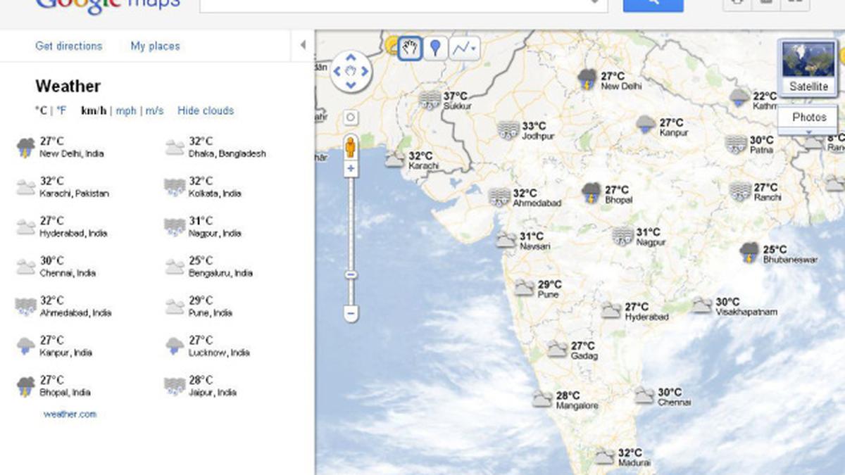
Internet search giant Google is providing current weather information and cloud data from across the world on its Google Maps application, a move that will hopefully make travel and activity planning easier.
“We’re adding a weather layer on Google Maps that displays current temperatures and conditions around the globe,” Google User Experience Designer Jonah Jones said in a blog post on Thursday.
The company is providing this facility through an arrangement with weather.com and the U.S. Naval Research Laboratory.
The information about weather is visible through a widget in the upper right corner of Google Maps. Clicking on the weather icon for a particular city opens a window with data like current humidity and wind conditions, as well as a forecast for the next four days.
In addition, users can also click on the left-hand panel to change the units for measurement of wind speed and temperature and enable or disable the viewing of clouds when zoomed out from the map.
