

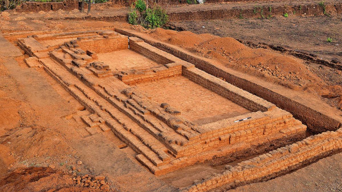
Excavations conducted by a team from the Department of Archaeology, University of Kerala, during the last three weeks in the medieval fort at Kumbla have unearthed a large hall, possibly meant for congregation.
The excavations are part of the research project ‘A Survey of Forts of Kerala’ jointly funded by the University Grants Commission (UGC) and University of Kerala. The excavation has also yielded large quantity of roof tiles, local pottery, Chinese shards, lead bullets and a mould to manufacture them.
The team comprised faculty members Ajit Kumar, .Rajesh.S.V and Abhyan .G.S, and two archaeologists from Japan,.Akinori Uesugi and Yasuji Shimizu from the universities of Kansai and Nara respectively. Twenty students of the Department of Archaeology and three research assistants also formed part of the team
The unearthed hall, which had an east-west orientation, had its entrance in the north. The building was exclusively made of dressed lateritic blocks and was plastered internally.
The hall was paved with lateritic stones and plastered and had three demarcated divisions caused by low wall rises on the floor, possibly indicating a hierarchical space distribution within the congregational hall, Dr. Ajit Kumar told The Hindu .
The roof was supported on large wood beams and lentils and the roof was laid with terracotta tiles.
This palace, considering its nature of construction, seems to have its origin in the 17{+t}{+h}-18{+t}{+h}century during the reign period of the Bednur Nayakas. The palace structure did undergo many additions and alteration in subsequent period, to retain its stability and utility, he said.
“The Kumbla area was under the hegemony of the Raja of Maypadi Kovilakam who had a jurisdiction extending from Kumbla to Chandragiri River in the south. During the zenith of the Vijayanagara Empire, this area was under their control and later it passed hands to the Nayakas of Bednore, and the local Raja acted as their feudatory. It passed to the hands of the Mysore rulers and subsequent after the defeat of Tipu Sultan by the British, it fell into their hands, Dr. Ajit Kumar explained.
The fort is situated 14 km north of Kasaragod and the closest railway station is Kumbla, two km away.
The Mangalaore-Kannur rail line passed by the side of the western fall of the fort and the Mangalore-Kasaragod road passes right through the fort.
The roughly trapezoidal fort can be characterised as a “land fort.”
It is situated on a lateritic hillock on the right bank of the Arikady River.
