

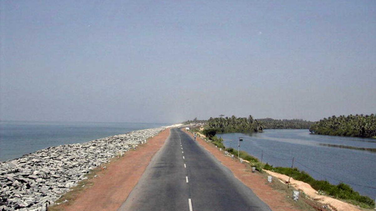
Travellers on their way to Karwar from Udupi cannot miss the serene beauty of Maravanthe – a rare location where one has the company of roaring sea on one side of the road and calm river on the other.
While the origin of the name Maravanthe is not well documented, many believe that it could have come either from the principal deity of the village —Maharajaswami Varaha Temple, or through the dense forest the village once had.
Mara, meaning tree in Kannada, once dominated the region, which could have been the origin of the name Maravanthe, said S. Janardhan, a retired government college principal and the former Maravanthe Gram Panchayat chairman. Locals have shortened the temple’s name to “Maraswamy”, which could also have lent the place its name, Mr. Janardhan said.
The village, located about 109 km north of Mangaluru, has come on the world tourism map for its pristine beauty. The National Highway 66 here passes on a narrow stretch of land between the Arabian Sea and the Souparnika, which flows down from Kollur.
The Souparnika has also formed a small 100-acre island, Kuru Kudru, near the Varaha Temple. The island is inhabited by farmers.
Locals believe that the Varaha Temple, located atop a boulder on the banks of the Souparnika, has been preventing the confluence of the river with the sea at that location. The Souparnika takes almost a ‘U’ turn thereafter, flows down south and joins the Arabian Sea at Gangolli along with four other rivers – Varahi, Kedaka, Chakra and Kubja – which together are called Pancha Gangavali.
Every monsoon, the sea waves assault the National Highway. but the road has remained intact thanks to the annual dumping of boulders along the beach. The sea along the highway is quite deep and people are advised against venturing into it.
